


Le plateau de la Molière

cbenoit38
User
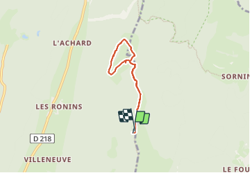

Length
5.5 km

Max alt
1640 m

Uphill gradient
113 m
Km-Effort
7 km

Min alt
1552 m

Downhill gradient
113 m
Boucle
Yes
Creation date :
2023-08-17 08:55:54.0
Updated on :
2023-08-22 13:42:55.382
2h51
Difficulty : Very easy

FREE GPS app for hiking
 SityTrail
IGN / Geographical institutes
SityTrail Plus
The world is yours!
About
Trail Walking of 5.5 km to be discovered at Auvergne-Rhône-Alpes, Isère, Autrans-Méaudre en Vercors. This trail is proposed by cbenoit38.
Positioning
Country:
France
Region :
Auvergne-Rhône-Alpes
Department/Province :
Isère
Municipality :
Autrans-Méaudre en Vercors
Location:
Autrans
Start:(Dec)
Start:(UTM)
703527 ; 5008201 (31T) N.
Comments